| Name | Location |
| Chris Adams | San Diego |
| Arlene Basada | San Diego |
| Karen Keyer | San Diego |
| Melody Lashlee | Menlo Park |
| Charles Petrie | Mountain View |
| Rufus Shaw | Bay Area |
| Anita Shaw | Bay Area |
| Bob Sturm | Bay Area |
| Deborah Tostevin | Bay Area |
| Jason Hupe | Los Angeles |
| Peter Targtagli | Los Angeles |
| Raymond Calderon | Los Angeles |
| Keith Vogel | Los Angeles |
| Jackie Geving | Los Angeles |
| 5 Open Slots | Where Ever |
Whitney was named after Josiah Whitney, chief of the California Geological Survey from 1860 – 1874. Mt. Whitney was first summited on August 18, 1873 by Charles Begole, A. H. Johnson, and John Lucas, who were fishermen from Lone Pine, California.
At 14,505' (4,421 meters), Mount Whitney is the highest point in the Continental United States. It is less than 90 miles from Death Valley, the lowest point of the United States. The estimated elevation of Mount Whitney s peak has changed over the years. Although it is often (incorrectly) assumed that the peak is growing, it is not. Instead, the vertical coordinate system has changed due to more advanced technology. The previously recorded altitude of 14,494' was based on a vertical datum from 1929. Now, elevation measurements are more accurate. For the most up-to-date geodetic information from the National Geodetic Survey, go to: http://www.ngs.noaa.gov/cgi-bin/ds_pid.prl [Type GT1811 in the SQUARE white box, click “Submit,” click “Select All”, click “Get Data Sheets.”]
The hike to the summit from Whitney Portal is 21.4 miles round trip, with an elevation gain of 6,100 feet. Elite trail runners can make it to the top of Mt. Whitney in under three hours. The average hiker takes 10 to 16 hours to summit Mt. Whitney from the Whitney Portal Trailhead.
LocationNational ParksCalifornia State Parks Highway 395 Lone Pine trails Bishop Weather Whitney Portal Store and Message Board Trailhead Shuttle Whitney HikingMt Whitney home pageMt. Whitney Weather Excellent climbers information. Good Trip Report with gear and maps. GearLightweight GearBackpacking light Ray Jardine's Lightweight Gear Kits Tyvek lightweight waterproof cloth Climbing.Org These are the approximate distances from the Portal to the Summit:
Default Hiking Plan Some people may want to try to backpack to Trail Camp.
For the record...Check how Whitney compares with other mountains |
CampingChoices for camping include:
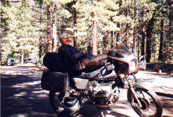
Rough Shedule for Meeting UpThe Whitney Zone permit is for the 24th through the 26th. Melody and Deborah have permits for Whitney Portal camping at campsites 3 and 8 for the night of the 23rd. Chris' plan is to stay at the an old hotel in Lone Pine Friday the 22nd across from the old County Court Building. Chris rides a whiskey-colored motorcycle and wears a yellow jumpsuit. Rufus' plan is to stay with Anita also in Lone Pine on Friday night, possibly at the Dow Villa, and they ride with Melody up to Whitney Portal to camp there on the 23rd. Charles' plan is to go up a few days early, camp at altitude Thus and Fri nights, pick up the permits at the Visitor Center on Sat the 23rd, and spend that night at Comfort Inn at Lone Pine, 1920 S. Main, (760)876-8700, geting to Whitney Portal before noon on Sunday the 24th. Charles rides a silver-grey BMW R80ST and wears brown leathers. Melody will pass through Lone Pine late afternoon on Friday the 22nd and try to find Chris. She will meet up with Rufus and Anita and give them a ride. Deborah, and Bob will arrive in Lone Pine Saturday and go directly to the Portal. Since Charles is camping somewhere on Friday the 22nd and is only coming into Lone Pine on the 23rd, he'll have to come up to the Portal and distribute permits on Saturday. Arlene and Karen will be somewhere in the area starting Friday and plan to link up at the Portal on Saturday. |